Founded in 1994, our company has been offering products and solutions to various stakeholders in the public and private sectors, as well as abroad, since 2012. Our expertise spans Unmanned Systems, Unmanned Aerial Vehicles (UAVs), Autonomous Tractor Systems, GNSS Positioning Systems, and Composite Manufacturing. We also undertake various projects as a main contractor. With a strong focus on high value-added technologies, we work continuously to meet the needs of our country, particularly those of the Turkish Armed Forces, while enhancing our capabilities with the ambition of becoming a global player. Today, UZMAN MÜHENDİSLİK has a team of over 10 employees, most of whom are expert engineers and technical professionals.
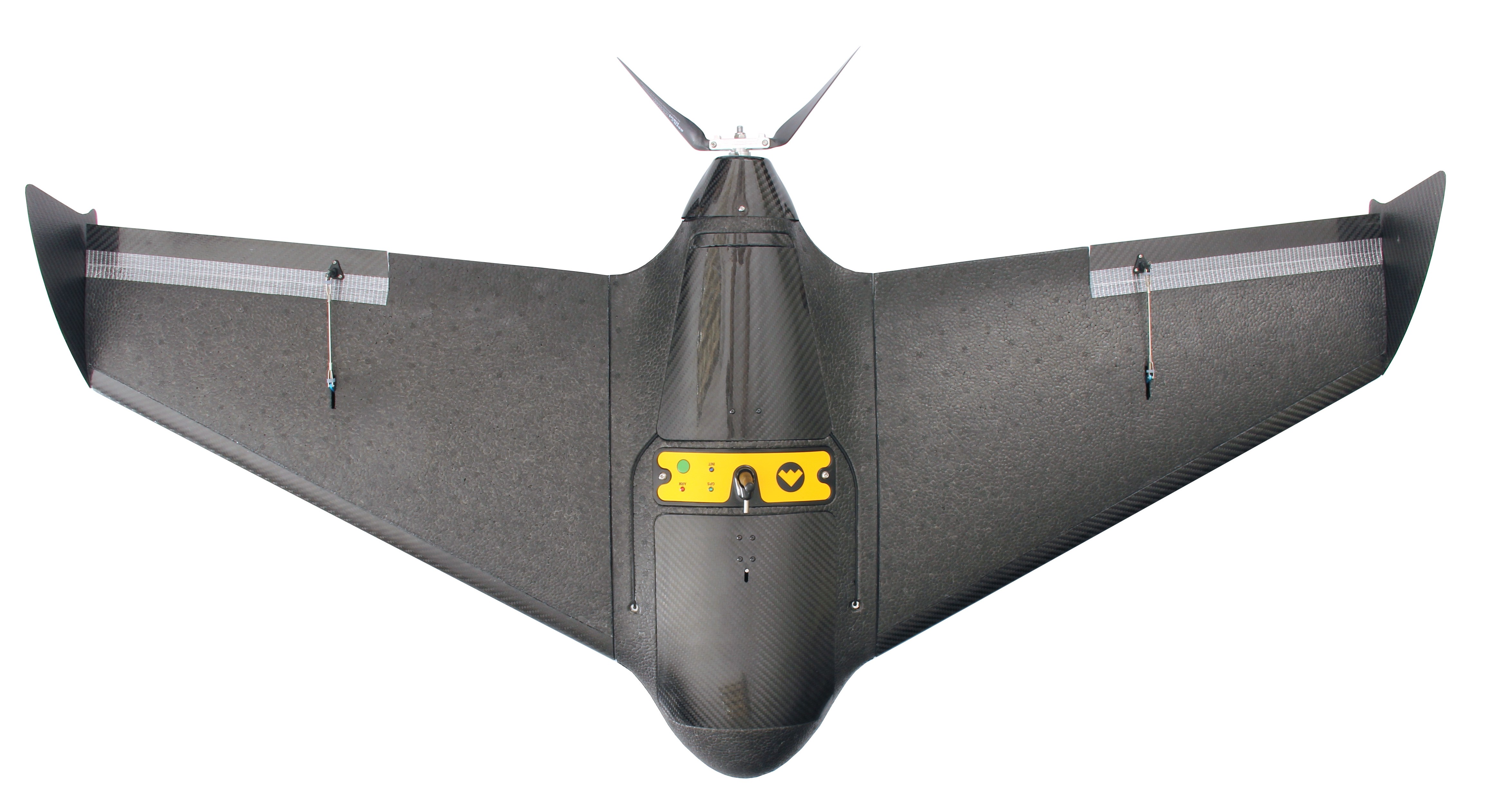
A platform developed for mapping missions, reinforced with EPP and composite materials. The built-in autopilot provides stable flight in all weather and ensures accurate path tracking. Location-based camera triggering reduces the number of photos and shortens post-processing time. Integrated safety systems constantly monitor OTUS’s functionality, enabling timely emergency landing or return-to-home decisions. The parachute ensures a safe and smooth landing in both planned and emergency situations. Weight: 2.3 kg Wingspan: 120 cm Flight Time: 50–70 min Range: 60–84 km Cruise Speed: 72 km/h Ceiling: 5000 m MSL Launch/Landing: Catapult / Parachute
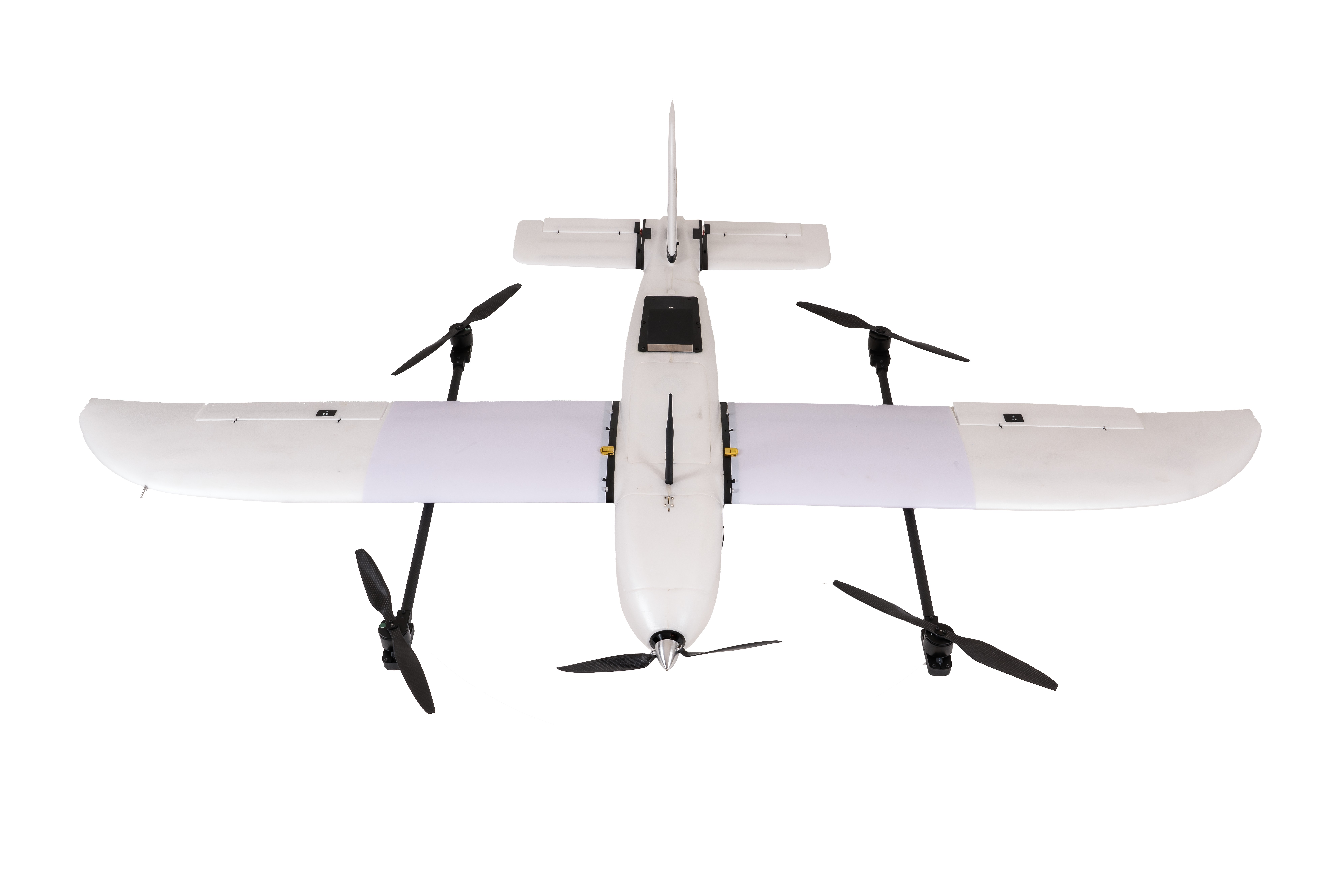
The AI-powered autopilot continuously monitors Martı’s functionality. Upon detecting unreliable GNSS signals, it switches to GNSS-free flight mode. If signals don’t recover within 5 minutes, it initiates return-to-home to ensure vehicle and ground safety. In both planned and emergency cases, it performs safe landings with vertical landing capability. Weight: 8 kg Wingspan: 222 cm Flight Time: 70–90 min Range: 80–110 km Cruise Speed: 72 km/h Ceiling: 5000 m MSL Take-off/Landing: VTOL Payload Capacity: 1.0 kg CRP Antenna: Tualcomm Tualaj 8200 Jamming Detection: Yes Return Under Jamming: Yes Mission Continuation Under Jamming: 5 min Weather Limit: 43 km/h Wind, Light Rain Camera: 24–42–61–100 MP
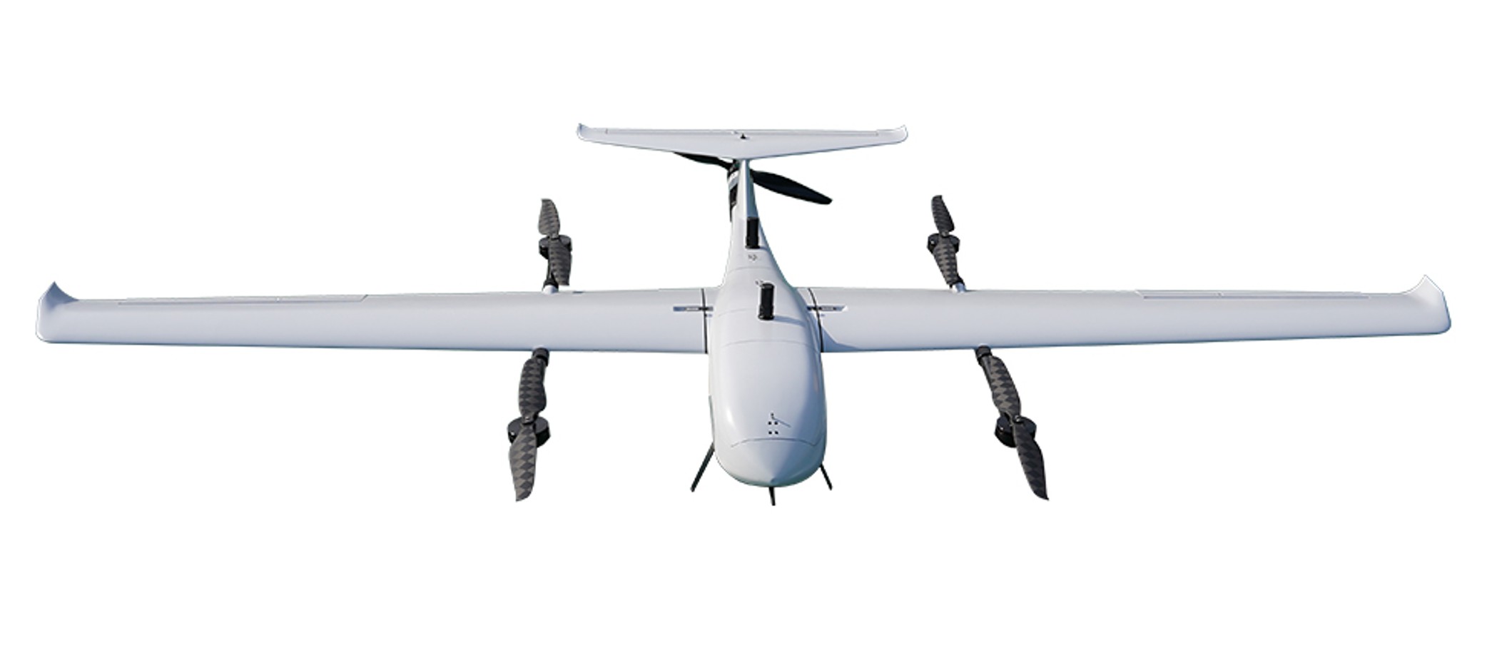
The AI-powered autopilot continuously monitors KUZGUN’s functionality, instantly checking positioning signals from the 8200 CRP antenna and TRNAV system. It uses the safest available navigation source. If both fail, a safety protocol activates, allowing 5 minutes of autonomous flight. If GNSS signals don’t recover within 5 minutes, return-to-home is triggered to ensure safety. Weight: 19 kg Wingspan: 290 cm Flight Time: 150–240 min Range: 175–280 km Cruise Speed: 72 km/h Ceiling: 6500 m MSL Take-off/Landing: VTOL Payload Capacity: 5.0 kg CRP Antenna: 8200 TRNAV Support: Yes Jamming Detection: Yes Return Under Jamming: Yes Mission Continuation Under Jamming: 5 min Weather Limit: 43 km/h Wind, Light Rain
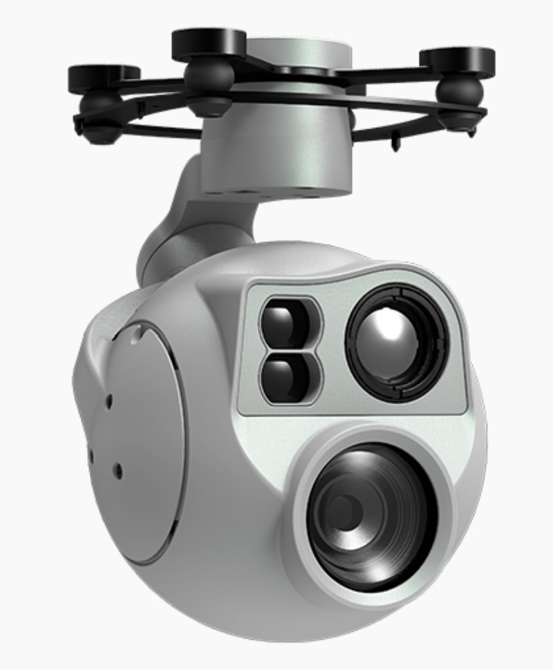
Dimensions: 142 x 125 x 187 mm Weight: 1055 g Operating Voltage: 20 ~ 53 VDC Power Consumption: 10.7 W (Static, measurement off) / 40.0 W Gimbal Type: 3-axis Non-Orthogonal Mechanical Stabilization Angular Accuracy: ±0.01° Control Range: Pitch: -120° to 40°, Roll: ±40°, Yaw: ±360° continuous Maximum Control Speed: ±200°/s Image Sensor: 1/2.8-inch CMOS, Effective Pixels: 4.09M Lens: Actual Focal Length 4.7–141 mm (Equivalent: 27.9–837 mm) Aperture: f/1.5–f/4.0 Resolution: 2688 (H) x 1520 (V) Pixel Size: 2.0 μm (H) x 2.0 μm (V) Optical Zoom: 30x Digital Zoom: 4x Thermal Camera Resolution: 640 (H) x 512 (V) Pixel Pitch: 12 μm (H) x 12 μm (V) Equivalent Digital Zoom: 8x Spectral Band: 8–14 μm Sensitivity (NETD): <50 mK @ F1.0 @ 25ºC
Mobile Applications